Softwareentwicklung Heinz Lüdert
PreFlight comes with an administration of maps, which makes it possible to use different kinds of maps for planning
your flights. New: The maps can be scaled and centred within certain limits.
All airports, radio navigation facilities and reporting points, stored in PreFlight's database can be made
visible on that maps, if necessary. If you reach the edge of a map, "PreFlight" automatically
changes to the next map.
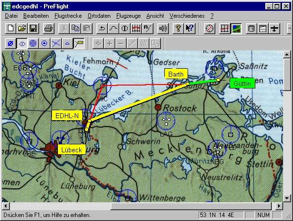
A simple geographical map of Germany is in the scope of supply. You can scan maps of any region you like by yourself
to use them within "PreFlight". Use a flat bed scanner in order to scan your ICAO or visual
approach charts. PreFlight 4.1 supports two kinds of map projections:
(The projection describes the way, how the spherical earth's surface is transformed into a two-dimensional map.)
Here are two map examples, which however are not contained in the download:
|
|
|
| ICAO chart (Cone projection) |
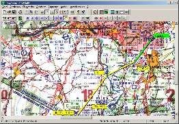
Traffic circuit on the city map (Linear projection) |
 |
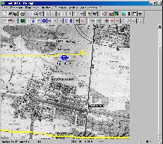 |
Cone Projection
This kind of projection is suitable for ICAO charts.
To scan your maps, you have not to cut them!
PreFlight's documentation describes a simple procedure, to be used to scan even large maps in several sections.
Thus you can use any cone projection map you like and beyond that, you still save expensive royalties, which would
result with purchasing already scanned ICAO charts.
Linear Projection
This kind of projection is suitable for visual approach charts or for city maps.
You can use this projection for all maps, which cover only an area up to approximately 50 km.
On this relatively small surface the spherical shape of the earth can be neglected. Thus to transform the
real surface into a two-dimensional map, a simple approximation procedure can be used.
This also makes possible a faster calibration, where it's already sufficient,
if you know the geographical co-ordinates of at least one map point.
On the ICAO chart you see a way point with the name "49 47N 8
21E". It was computed by PreFlight. That is the position, where you have reached your cruising altitude.
The red lines are radials, used for radio bearings.
Therefore, in the flight execution plan you will see data like
"133/32.3NM FROM Kirn VORTAC (117.50 MHz)".
Geographical map of Germany (contained in the basic price) with overlay