 |
 |
 |
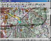
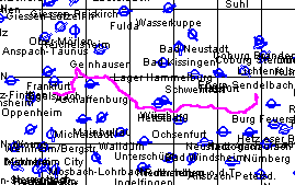
| On the ICAO chart (95 KB) | On the static elevation profile (88 KB) | On the dynamic elevation profile (104 KB) |
With "PreFlight" you cannot only transfer flight routes and recorded tracks
between computer and GPS, but also follow your current position on a map,
while "PreFlight" stores both track and altitude.
Transferring Flight Routes
PreFlight supports the device-specific protocols for Garmin and Magellan GPS devices.
Thus you can directly send and receive data from the following devices:
"GPS III", "GPS 55 AVD", "GPS 90", "GPS 95XL", "GPS
100 AVD", "GPS 150", "GPS 190", "GPSMAP 195", "GPSMAP 196",
"GPSMAP 295", "GPSMAP 296" and Magellan 315/320.
Without any additional software you can:
|
|
|
|
| On the ICAO chart (95 KB) | On the static elevation profile (88 KB) | On the dynamic elevation profile (104 KB) |
Recording the Route Flown in your Computer
Via the NMEA 0183 interface (4800 bps), "PreFlight" records your track,
while your current position is indicated on a map, where a black line marks your planned course.
To record track and speed, you can use all GPS devices, equipped with a NMEA 0183 interface.
Beyond that, with Garmin devices its also possible to record the flight altitude.
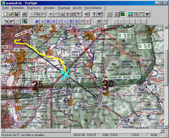
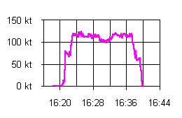
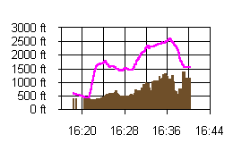
Flight from Egelsbach to Mainbullau including speed and elevation diagrams.
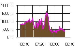
Trip from Bamberg to Darmstadt including position and altitude diagrams.